—
10:00 AM
Tropical Storm Eta continues to move away from southwest Florida although flooding rains continue. The latest update from the National Hurricane Center now keeps Eta below hurricane strength as it turns northeast.
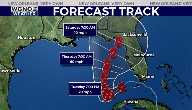
There is still a large range of possibilities with the future track, including one that moves more west into the central Gulf. It’s possible this track changes over the next few days so please stay aware as we go through the week.
Otherwise a nice afternoon is on the way with upper 70s and a breeze out of the northeast.
—
7:30 AM
Temperatures are going to be above average for the next week or more as mild conditions look to stay with us through a good portion of the rest of the month.
Look for afternoon highs around 80 through the week with overnight lows only dropping into the mid to upper 60s. A weak front on Thursday will mean some spots cool into the upper 50s by Friday and Saturday mornings in the northern areas.
In the tropics we are watching Eta as it moves off the coast of Florida. While the official track has this moving northeast towards the bend area of the state there is a lot of model disagreement.

You can see a good cluster of these actually move the storm into the central Gulf and then turn northeastward from there. Most likely a storm that follows that path would be weak but obviously that will need to be watched over the next few days.
We will most likely continue to see a lot of model shifting over the next few days. As always stay prepared and stay with us at WGNO for the latest.
Check out current conditions near you: https://digital-release.wgno.com/weather/new-orleans-weather-radar/
Stay up to date with the latest forecast: digital-release.wgno.com/weather/forecast/
Download the WGNO Weather App to stay connected this hurricane season