NEW ORLEANS – City of New Orleans Homeland Security Director Collin Arnold says the city will stay on high alert as Hurricane Laura heads toward landfall near the Texas border.
Arnold said he is relieved that Tropical Storm Marco turned into a non-event for residents of Orleans Parish, he urged vigilance as Hurricane Laura makes its way across the Gulf of Mexico.
“We’re still not out of the woods,” Arnold said. “We have to stay on a vigilant footing, I believe, with Hurricane Laura.”
Even before Laura strengthened to a hurricane, Arnold said its impacts were felt far away from the center of the storm.
“While Laura was a tropical storm and 210 miles south of Key West, they had 60 to 70 mile per hour winds,” he said. “That’s 210 miles away, so obviously, when they talk about being on the East side of the storm, and in a 150 mile to 200 mile range, that puts us in the distinct possibility of having tropical storm force winds and heavy rain.”
Those impacts could be felt as early as tonight and last through Thursday. In the meantime, crews from the City of New Orleans are offering assistance to emergency centers in Texas and southwestern Louisiana in advance of landfall.
“Obviously, the City of New Orleans will help them as much as we can,” Arnold said.
Check out current conditions near you: https://digital-release.wgno.com/weather/new-orleans-weather-radar/
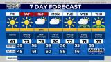
Stay up to date with the latest forecast: digital-release.wgno.com/weather/forecast/
Download the WGNO Weather App to stay connected this hurricane season