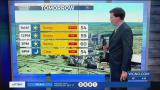
The National Hurricane Center issued a forecast cone for Potential Tropical Cyclone 6 (PTC 6) at 4PM locally that includes the southeast Gulf of Mexico!
Right now, a tropical wave near the Lesser Antilles looks impressive for formation potential with 80% chances of development.
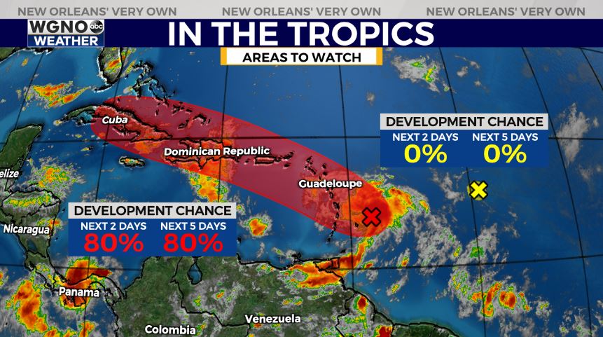
A tropical depression will likely form Monday night or Tuesday, and tropical storm warnings may go into effect for the Lesser Antilles, Virgin Islands, and Puerto Rico shortly. Remember, these are issued 48 hours before tropical storm conditions occur.
The Hurricane Hunters have three crews relocated to Homestead Air Force Base in Homestead, Florida ahead of upcoming missions to fly the disturbance.
Right now, PTC 6 looks to impact the Lesser Antilles tonight before moving near the Virgin Islands and Puerto Rico Tuesday, then Hispanola Wednesday.
Spaghetti models are in incredible agreement the system will likely track west toward our United States coastline from there.
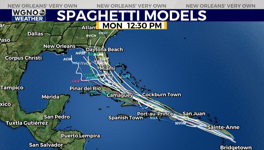
Right now, the forecast track cone includes the southeast Gulf of Mexico just west of Florida’s most southern tip. The good news about this system is that it will likely remain weak in intensity after moving over mountainous terrain combined with the dry air and wind shear it encounters. These three factors will likely keep the system weaker, only allowing strengthening to a tropical storm or low end hurricane.
The next name on the list is Fred, so we will continue to watch closley, though local impacts are not a concern right now.
Join in for more information on WGNO News at 5PM, 6PM, and 10PM tonight!