Scattered showers and storms will still be in the forecast as we go through the next few days. Not a total washout! But there will be some rain that you have to dodge.
A mainly stationary frontal boundary is draped across the area. It actually has some drier air north of it and a bit nicer fall feel. However for most of southeast Louisiana and southern MS we will see warmer and more humid air.
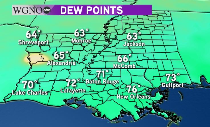 Dewpoints are in the 60s north of the front but in the 70s south which means more humidity.
Overall rain chances will be in the 50% range. We’re not going to see large widespread areas of rain most likely, but there will be numerous spotty showers and storms. The best chance for these will be during the early to mid afternoon time frames.
Temperatures will mainly be in the mid to upper 80s for highs. A lower rain chance will mean a bit hotter temperatures next week.