Happy All Saints Day! Our forecast for New Orleans has been dreamy after a cold front swung through earlier tonight to bring relief in the form of humidity and temperature!
Dry air will be behind this air mass, sticking around for foreseeable days ahead! Rain chances remain tough to come by all week!

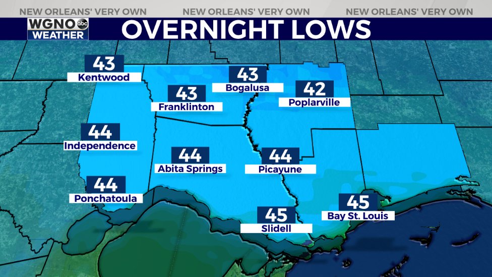
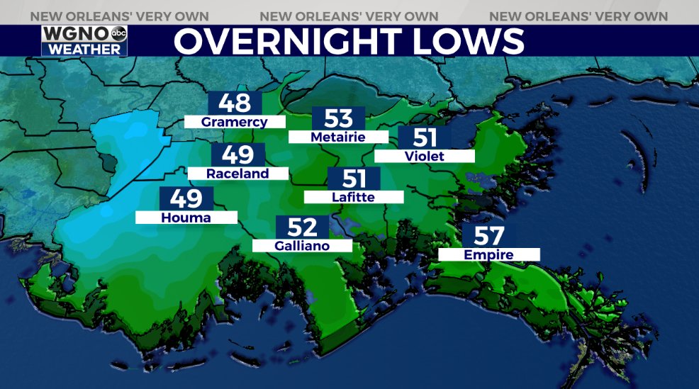
Northshore residents likely wake up with 40s outside their windows tomorrow morning while Southshore residents can anticipate 50s! This is sweater weather, but you’ll really need those jackets by Tuesday morning for voting!

Climate Prediction Center outlooks show conditions stay below average during your upcoming week! Finally, again in southeast Louisiana, it feels like Fall once more!
Election morning, Northshore lows will be in the 30s, while Southshore lows will be in the 40s-50s! Afternoon highs will remain in the 70s, ten or so degrees warmer than our forecast for tomorrow afternoon!
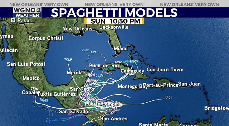
Remember, Hurricane Season 2020 does not end until November 30th. We are closely watching Tropical Storm Eta, which should be becoming a hurricane within 24 hours before making landfall across Central America.

Right now, this is no immanent concern here locally but worth keeping an eye on based off of its projected track!
Enjoy indulging in sweater weather! We have a 100% chance of Meteorologist Scot Pilie’ issuing his Gumbo Warnings soon! ‘Tis the season!
Check out current conditions near you: https://digital-release.wgno.com/weather/new-orleans-weather-radar/
Stay up to date with the latest forecast: digital-release.wgno.com/weather/forecast/
Download the WGNO Weather App to stay connected this hurricane season


