
Potential Tropical Cyclone 16 was initiated by the National Hurricane Center Thursday morning in preparation of the system becoming a named storm. The potential classification is basically to get a jump start on posting the forecast tracks and impacts from a storm.
The forecast track takes this storm quickly to the northeast with the center remaining southeast of the mouth of the Mississippi River. This will be making landfall Saturday along the Florida panhandle. On this track the impacts will be on the low side for southeast Louisiana and southern Mississippi. 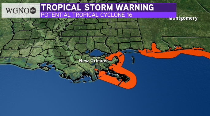
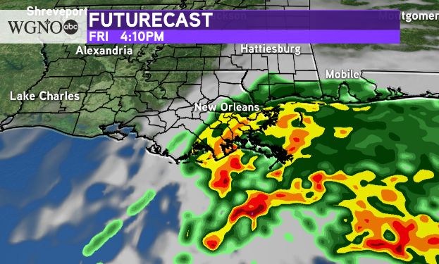
Overall impacts inland will be stronger on the south shore. Expect a chance for winds up to 35 mph with locally heavy rain. Minor coastal flooding can also be expected, especially on east facing coasts in Plaquemines and St. Bernard.
As always stay with WGNO on air and online for the latest.