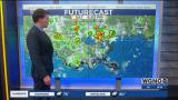
Major shift EAST with the track of Tropical Storm #Marco, with greater impacts now expected to southeast Louisiana and south Mississippi.
Heavy rainfall, hurricane force winds, & storm surge will be concerns with impacts arriving late Sunday night through early Tuesday, with landfall expected mid day Monday.
Expect scattered passing showers on Sunday, so plenty of time to finish preparations tonight-tomorrow.
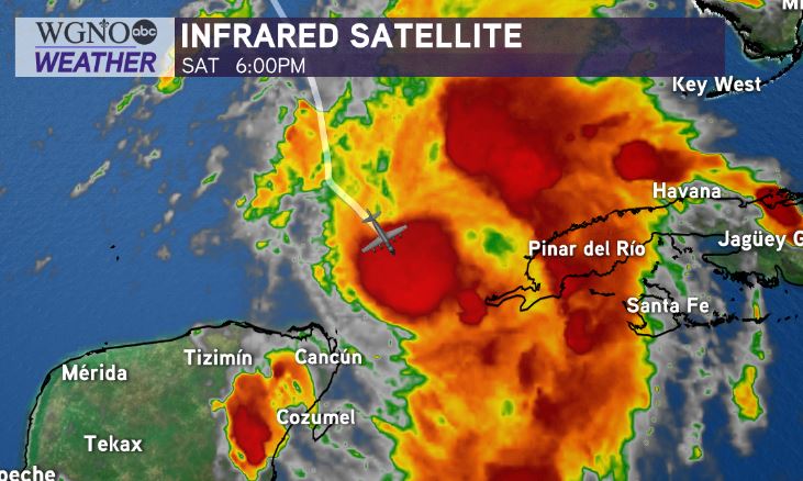
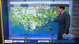
Right now, Tropical Storm Marco has max winds of 65mph. Hurricane Hunters are en route to investigate to see if the system is now a hurricane.
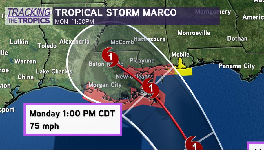
Latest track from the NHC brings intensity to 85mph in the Gulf of Mexico by Sunday, with slight weakening to 75mph before landfall on Monday afternoon.
Additional intensification is forecast. However, due to Marco’s small size, it will be more susceptible to swings in larger swings in strength, both up & down! Not out of the question system could stay weaker…here’s why:
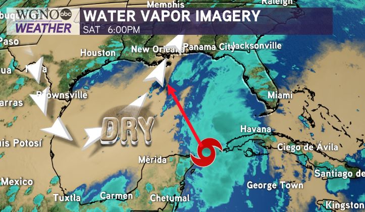
We still have a STOUT dry air mass in the western Gulf of Mexico. This dry air will likely inhibit intensification of #Marco on approach to Louisiana. Still though, with Marco being slightly further east, environmental conditions may not be nearly as hostile as previously thought. Water temps are very hot, so it will be closely watching.
In addition, remember, if Marco’s track shifts further east, that would drastically reduce impacts in southeast Louisiana & south Mississippi!
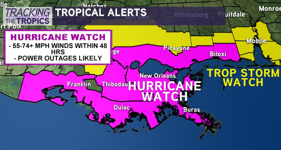
Hurricane Watch issued from Intracoastal City, #Louisiana to the MS/AL border in advance of #Marco. This means hurricane conditions possible within 48 hours.
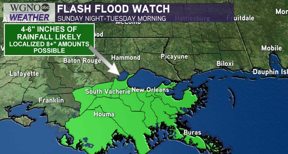
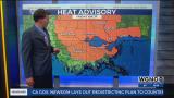
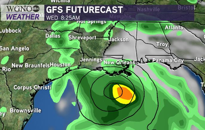
Locally heavy rain the primary risk with sporadic power outages likely in southeast Louisiana/south Mississippi Monday-early Tuesday. Flash Flood Watch in effect.
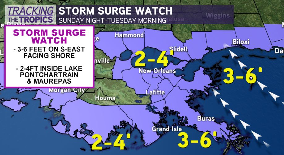
Storm Surge along the coast will also be a concern. 3-6 feet of storm surge outside levee protection from Grand Isle to the MS Coast. 2-4 feet inside Lake Pontchartrain & Lake Maurepas.
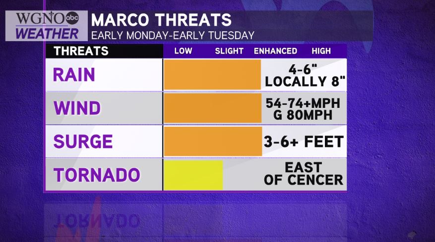
Coastal flooding, heavy rainfall 4-8 inches, and hurricane force winds will be possible.
Finish preparations tonight-early tomorrow while the weather is still nice!
Clean out catch basins & storm drains, secure loose items, restock hurricane safety supplies.
Laura will be right on Marco’s heel with impacts possible by early Wednesday...
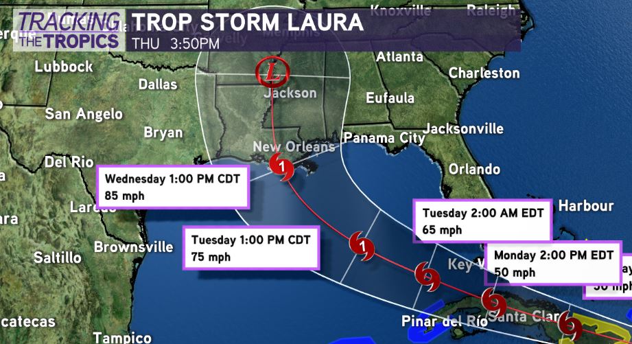
TROPICAL STORM #LAURA — Intensifying near Puerto Rico. Latest forecast track shows a shift east with with the forecast track, showcasing a landfall Wednesday in south Louisiana as a hurricane with 85mph winds.
The key? Appears this system could of greater concern to northwest Gulf Coast on the heels of #Marco, but this threat will be highly dependent on how much land interaction in Cuba/Hispaniola disrupts this system’s ability to organize.
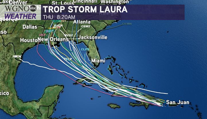
Could the track shift even more in the days to come? Yes! Forecast models range in location of landfall from south Texas to the Florida Panhandle
Keep in mind forecast models WILL change from run to run. We’re still 4-5 days out from any potential landfall near our area, so plenty of time to watch trends!
Based on current track, Laura could bring all forms of impacts. Wind, surge, and heavy rain risk. But, we don’t yet know the magnitude of risks until the track guidance becomes more clear after system’s interaction with Cuba/Hispaniola.
For residents along the Gulf Coast from Texas to Florida, I would be reviewing your hurricane preparation plans & restocking hurricane safety kits. Being proactive, just in case, can save you lots of stress and hassle if this system also decides to head our way.
Check out current conditions near you: https://digital-release.wgno.com/weather/new-orleans-weather-radar/
Stay up to date with the latest forecast: digital-release.wgno.com/weather/forecast/
Download the WGNO Weather App to stay connected this hurricane season