A line of storms will be moving across the area this evening bringing with it the threat of damaging wind gusts and an isolated tornado. Most of the severe weather threat will stay north of our viewing area through the evening.
We are under a Tornado Watch until 9PM this evening due to this severe weather potential.
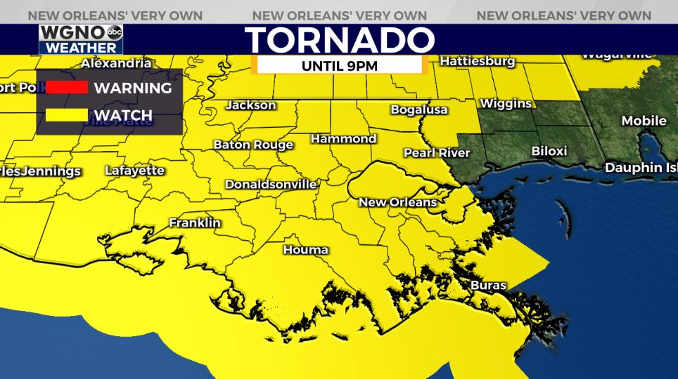
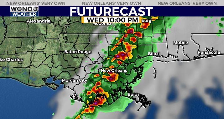
The storms will be moving across the area through midnight. Look for the activity to be in the immediate New Orleans area by 9-10. After that the line will continue to push east into southern Mississippi and Alabama by 1-2 AM.
Much nicer weather will be moving in behind this system although cooler. Look for breezy and drier weather Thursday with northwest winds of 15-20 and temperatures only in the mid to upper 60s.
Check out current conditions near you: https://digital-release.wgno.com/weather/new-orleans-weather-radar/
Stay up to date with the latest forecast: digital-release.wgno.com/weather/forecast/
Download the WGNO Weather App to stay connected this hurricane season