It is still mild around the area this evening and will be until the front moves through later tonight.
Right now it looks like the front moves through late tonight and very early tomorrow morning, mainly in the overnight time frame. Expect a band of showers along the front as it moves through although overall rain amounts look light.
However unlike the past couple of fronts this one looks to get hung up over the area. That will mean a chance for showers continuing through the day, especially on the south shore.
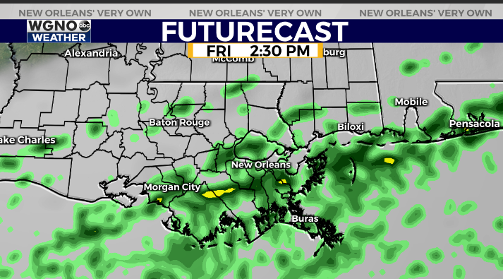
Cooler temperatures will also move in with the front meaning a colder and gloomy day. It will not be very pleasant outside.
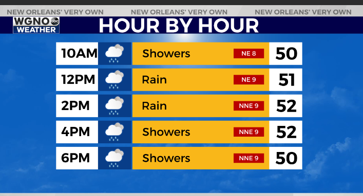
Temperatures will struggle to make it out of the low 50s with the off and on showers. Expect cool conditions on Saturday as well with rain tapering off. Sunday will be a bit warmer with low 60s and dry conditions.
Check out current conditions near you: digital-release.wgno.com/weather/maps-and-radar/
Stay up to date with the latest forecast: digital-release.wgno.com/weather/forecast/
Download the WGNO Weather App to stay connected this hurricane season