Good Morning! Happy Black N Gold Friday! It’s a cold start across southeast Louisiana. Wind chills in the 30s & lower 40s. Clouds will hang around for much of Friday, but sunshine returns on Saturday.
Let’s talk about the chatter about Sunday night-Monday morning’s wintry weather potential for parts of the Deep South.
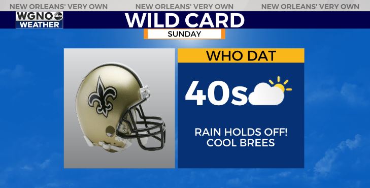
First things first, the good news? Our next chance for rain looks to arrive late Sunday night, well after the Saints-Bears playoff game! Any plans for the Wild Card matchup look good-to-go, but it will be chilly!
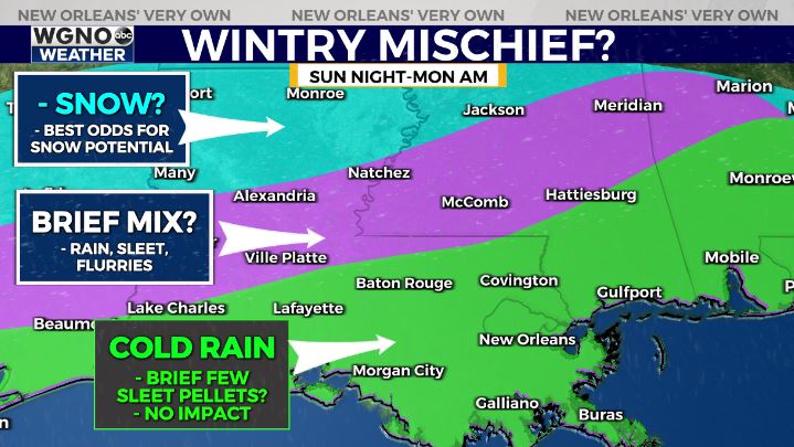
The system Sunday night-Monday morning continues to look interesting, especially for the I-20 corridor and north-central Louisiana. That’s where cold air will coincide with over-running precipitation from offshore low pressure system,

For south Louisiana, it’s looking too warm. More likely that we won’t see much besides a chilly rain![]() . Localized heavier rain possible of 1-2″ for areas south of I-10.
. Localized heavier rain possible of 1-2″ for areas south of I-10.
For far reaching areas of the Northshore into south Mississippi, late Sunday night the precipitation may begin as a few sleet pellets before switching to rain. Then Monday morning a brief rain transition to sleet/flurry mix does appear possible north of I-12/LA-10. No impacts expected.
![]() NOTE
NOTE![]() We’re still 2-3 days away from this *hint* of mischief on any model guidance. This graphic is simply preliminary thoughts. Simply something to check back in on!
We’re still 2-3 days away from this *hint* of mischief on any model guidance. This graphic is simply preliminary thoughts. Simply something to check back in on!