UPDATE: Matthew is now a hurricane.
————————————————
NEW ORLEANS (WGNO) – Tropical Storm Matthew continues to move west on Thursday morning as it passes south of Puerto Rico.
The latest intensity is 70 mph, placing the storm close to hurricane strength. This west movement will continue over the next couple of days before a turn to the north is expected. That sharp right turn will be due to a trough in the Gulf that picks the storm up and moves it north. Every forecast model is in agreement with this scenario, and so while it is worth watching at the moment there is no concern for our area.
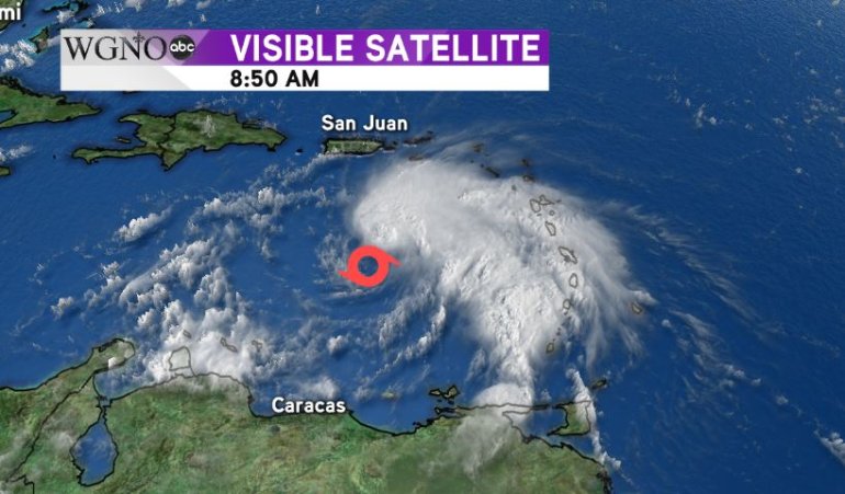
Matthew is dealing with quite a bit of wind shear.
The center of circulation is actually on the southwestern edge of most of the thunderstorm activity. This will diminish over the next couple of days and should allow for strengthening. The official forecast has Matthew increasing to category 2 hurricane status, although a stronger storm is possible. It looks like areas along the east coast could be impacted eventually by this storm.
At the moment there is not threat to southeast Louisiana or southern Mississippi. Stay with WGNO as we continue to monitor the progress of Matthew.