Good Morning, New Orleans, as a cloudy Muses Thersday begins across southeast Louisiana.
Ahead of yet another cold front, we’ll see balmy conditions all day today. Warmer temperatures are in the forecast for your afternoon as clouds stick around with storm chances increasing.
Highs will reach the upper 70s, near 80. A southerly breeze will continue through the evening as well with winds anywhere from teens to twenties!
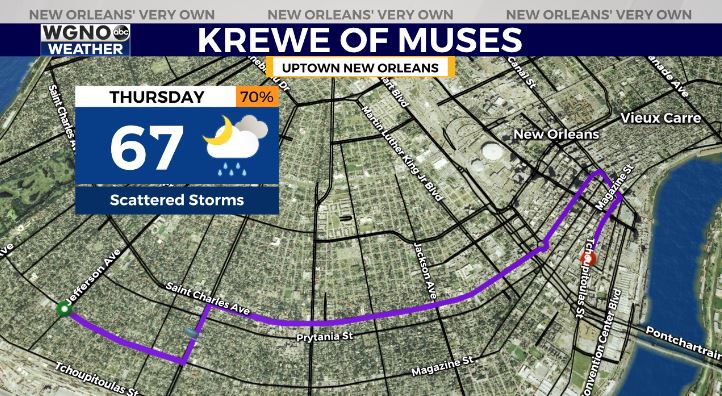
Rain chances jump to around 80 percent Thursday as a storm system moves through ahead of our next cold front. We’ll top out near 80 and be watching severe weather potential and timing closely late afternoon to tonight.
Right now, severe weather threats appear widespread on the Northshore for much of your day Thursday, and you can expect storms to fire up south of the lake during the evening. One more round of storms comes through overnight, and our primary impacts will be heavy rainfall plus gusty winds.

Behind the front, temperatures will be much colder Friday into the weekend before Mardi Gras! You can expect 50s for highs Friday and Saturday with 60s by Sunday.